Click on image for enlargement.
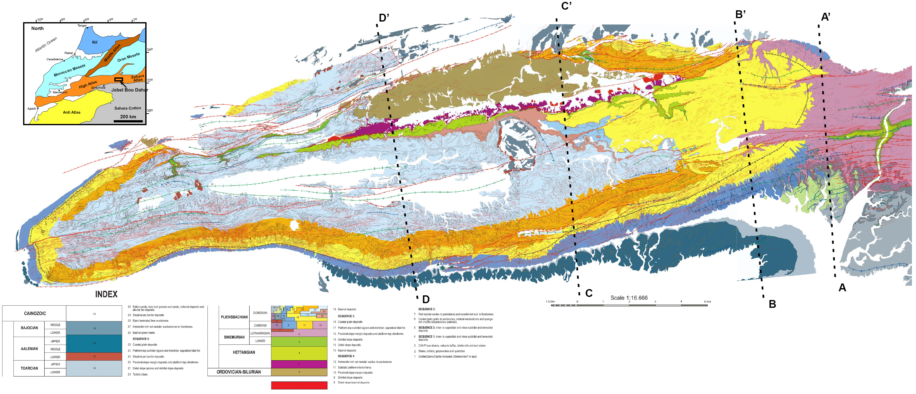
Geologic map of Djebel Bou Dahar, High Atlas, Morocco. Detailed GIS-based mapping was carried out using orthorectified Quickbird satellite imagery (0.7x0.7 m resolution) in Microstation software. Ammonite age dates provide detailed time constraints on platform stage development. AA’, BB’, CC’, and DD’ are lines of cross-sections.